Our multidisciplinary data is used to assist in the design and construction of projects, to minimise incident risks or delays.
Our Subsurface Utility Engineering (SUE) team combine civil engineering, geophysics, surveyance and computer aided design & drafting, to provide detailed information on the location and condition of subsurface utilities.
During an investigation, data is collated and assessed by our engineers to reduce any interference or conflict from occuring with existing infrastructure.
Adopting a SUE process during the life cycle of your project can alleviate unexpected utility conflicts, project delays, utility damage, community issues and contractor claims.
With an experienced team of surveyors, engineers, data depiction analysts and utility coordinators, we have the resources to provide a completely integrated SUE service for your next project.
Structural Scanning
- Concrete slab thickness
- Electrical cables within slabs
- Safe areas for cutting, drilling or coring in concrete slabs & walls
- Inconsistencies such as voids, cracks & honeycombing
- Corrosion & moisture management
Asset Management
- Strategic & operational asset management
- Asset registers, data capture & condition assessment
- Economic regulation & efficiency studies
- Infrastructure valuation
- Strategic business planning & financial analysis
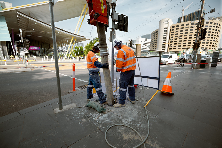
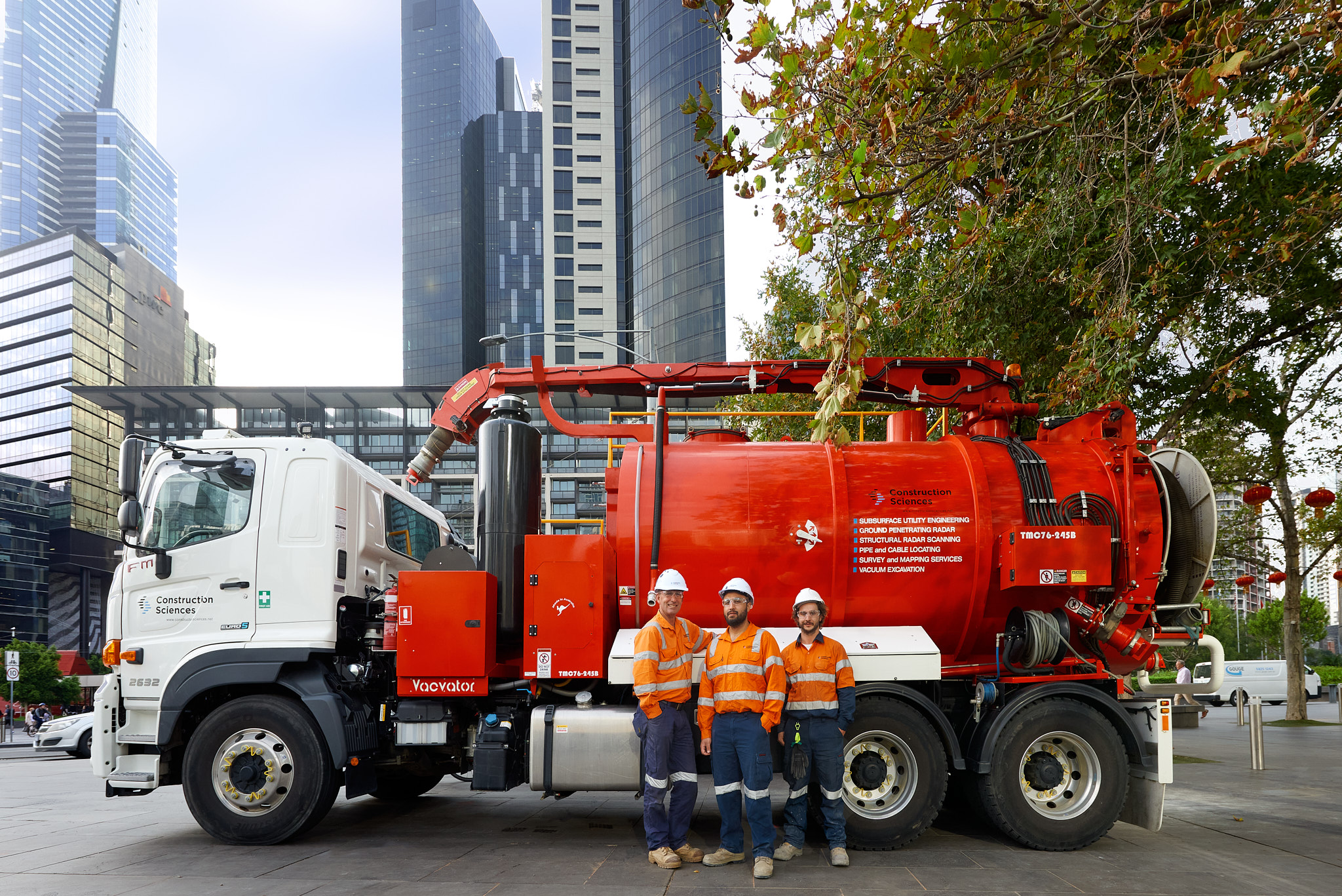
Vacuum Excavation
- Minimal surface disruption
- Reduced reinstatement costs
- Safe containment & disposal of soil in vacuum tank
- Reduced manual handling
- Minimised environmental impacts compared to conventional mechanical excavation
Utility Detection Mapping
- Ground Penetration Radar (GPR) technology
- Archeological & geological
features - Subsurface utilities
- Pavement profiles
- Concrete structures
- Underground storage tanks
- Bedrock and voids
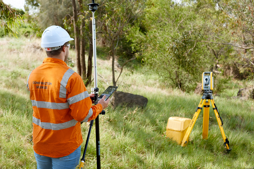
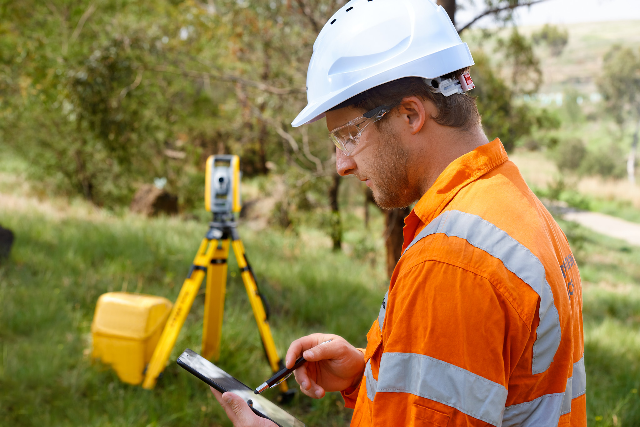
Survey, GIS & CAD
- Digital plan production facilities
- Record of assets & infrastructure
- Spatial & non-spatial data overlay
- Effective planning of construction works
Mapping assets beneath the surface
Our utilities team is considered a world leader in the provision of SUE and a major contributor to the development of the Australian Standard for the Management of Subsurface Utilities. Our team are accredited with Energy Queensland, Queensland Urban Utilities and Telstra certifications.
Project and utility owners, designers, engineers and contractors can significantly benefit from adopting a SUE process during the life cycle of a project to avoid unexpected costly utility conflicts, project delays, utility damage, community issues and contractor claims.
Our experienced team can provide an integrated SUE service combining:
- Preliminary/desktop research to obtain existing utility information
- Utility detection through the application of surface geophysical methods to identify the approximate position of subsurface utilities
- Ground Penetrating Radar (GPR) to identify various subsurface features and anomalies
- Structural scanning using Ultrasonic Pulse Velocity (UPV) to identify concrete inconsistencies such as voids, cracks and honeycombing
- Non-destructive digging (vacuum excavation) to expose subsurface utilities at critical points to obtain their exact coordinates/location and attributes
- Survey and depiction of subsurface utility data with in-house capabilities to output in various formats such as AutoCAD, 12D and/or GIS
- Professional utility coordination throughout the project lifecycle
- Utility specific detailed design engineering.
Construction Sciences uses both electromagnetic cable locating and ground-penetrating radar (GPR) technology to designate underground utilities without disturbing existing conditions.
This technology is suitable for all subsurface utilities, including electrical cables, fibre optic cables, and gas, sewer, water and storm water pipes.
Our staff are Dial Before You Dig (DBYD) accredited and have extensive experience across civil, industrial, petrochemical, agricultural and residential sites.
Construction Sciences also offers the application of GPR to obtain information for subsurface utilities, pavement profiles, concrete structures, underground storage tanks, bedrock, voids, archaeological and geological features.
For detailed condition reports of existing assets, including drain pipes, sewer pipes, wells, shafts and ducts, we deploy closed-circuit television (CCTV) technology and present results in hard copy and electronic formats.
Construction Sciences utilises advanced structural scanning technology to provide accurate information on concrete structures.
Structural scanning is a non-invasive technology that can detect concrete inconsistencies such as voids, cracks and honeycombing in all concrete structures up to half a metre, as well as shallow engineering and environmental applications.
Structural scanning is able to provide the following information:
- Concrete slab thickness;
- Location, spacing, size and depth of reinforcement;
- Location of prestressing cables;
- Electrical cables situated within a slab;
- Accurate location of penetrating exit points to avoid thickenings and beams in concrete floors;
- Inconsistencies such as voids, cracks and honeycombing;
- Safe areas for cutting, drilling or coring in concrete slabs and walls;
- Changes in concrete composition and any other conflicting anomalies;
- Corrosion and moisture measurement; and
- Schmidt Hammer testing to determine compressive strength (MPa).
Concrete imaging is an invaluable investigative method that provides project owners with critical concrete structure information. One of the most common applications is the detection of pre-stressing cables fitted in concrete structures. These high-strength steel strands are critical to the integrity of the structure, therefore understanding the exact positioning is crucial to avoid damaging them during drilling or cutting.
Other applications include bridges, tunnels, new buildings, restoration projects, car parks and any work involving concrete structures.
Construction Sciences offer complete subsurface utility and infrastructure reporting that can be passed onto engineers, site auditors, building inspectors and property owners.
Ground Penetrating Radar (GPR) is the most commonly applied structural scanning technology, using high frequency radio waves that transmit into concrete structures. Obstructions within the concrete are signalled by an echo. The strength and interval of the echo indicates the location of the obstruction. Concrete imaging is an invaluable investigative method that provides project owners with critical concrete structure information. One of the most common applications is the detection of prestressing cables fitted in concrete structures. These high-strength steel strands are critical to the integrity of the structure, therefore understanding the exact positioning is crucial to avoid damaging them during drilling or cutting.
Other applications include bridges, tunnels, new buildings, restoration projects, car parks and any work involving concrete structures. Construction Sciences has the experience and flexibility to identify, analyse and investigate for a variety of projects. Using concrete structure scanning on your project provides the following benefits:
- Non Destructive Testing – We have the ability to identify, detect and inspect your job site non-intrusively, allowing you to preserve the integrity of your structure.
- Cost Reduction – Concrete structure scanning reduces the risk of damaging prestressing cables, reinforcing steel and other undetectable structures. This, in turn, equates to cost savings associated to down time, repair costs and service interruptions.
- Risk Reduction – Structural scanning mitigates potential risks associated with the unknown location of in-situ assets, making your projects safer for all workers.
UPV provides a more advanced assessment of concrete structures than the current industry standard methods.
Using non-intrusive structural scanning on your projects provides the following benefits:
- On-site Structural Assessment with 2D and 3D tomography
- Improved Clarity and Measuring Depth
- More efficient than normal scanners
- Full Traceability of all data
- Our staff are trained to interpret the data and provide clear and concise reports.
Applications:
Quality Assessment and Uniformity
- Slab thickness measurement from a single side
- Delamination, void and honeycombing survey
- Detection of grouting defects in tendon cables
- Location of pipes and tension cables beyond the rebar layer
- Location of hollow pipes
- Assessment of fibre-reinforced concrete
Additional Capabilities:
- Subsurface Utility Engineering
- Utility detection and mapping
- GPR Capabillities
- Vacuum excavation
- Survey, GIS and CAD
- Professional utility coordination
- Asset management
- Construction Material Testing
- Geotechnical Investigation
- Environmental Services
- Calibration Laboratory Services
Commercial and Industrial Building Applications:
Construction Sciences can accurately detect the presence of prestressing cables and reinforcing steel within concrete structures. It is critical for contractors to identify these cables prior to drilling or cutting to avoid a potentially catastrophic incident of the structure collapsing if the integrity is threatened.
In Australia, Construction Sciences has pioneered non-destructive vacuum excavation and its application in subsurface utility engineering.
Non-destructive digging via vacuum excavation has several significant advantages including:
- Minimal surface disruption with reduced reinstatement costs
- Elimination of the risk of damaging costly subsurface utilities including protective coatings
- Rapid and cost-effective results
- Reduced manual handling (compared to hand digging), therefore removing the risk of personal injury to field workers
- Excavated soil can be contained in the vacuum tank and easily disposed of at approved disposal transfer stations
- Reduced environmental impacts. Vacuum excavation is a safer alternative to conventional mechanical excavation.
SUI Classification:
Construction Sciences played an important role in developing AS 5488-2013, the Australian Standard for the Classification of Subsurface Utility Information (SUI).
Developed by Standards Australia, the Standard provides utility owners, operators, and other stakeholders with a framework for the consistent classification of information to manage subsurface utilities, and has improved public safety and reduced the risk of damage to utilities.
There are four recognised quality levels of underground utility information ranging from Quality Level D (the lowest level) to Quality Level A (the highest level). The use of quality levels enables project owners to determine the level of information and accuracy they require for their project.
Quality Level D – Review of Existing Subsurface Utility Information
Our professional utility coordinators have considerable experience in sourcing utility records and other information relating to subsurface utilities, reviewing the information and ensuring that it is maintained and accurately rated.
Quality Level C – Investigation of Surface Features
Construction Sciences highly-skilled survey and field staff undertake field observations and survey visible surface features that are traditionally associated with subsurface utilities, including pits, manholes and valves/hydrants.
Quality Level B – Surface Geophysical Methods
We apply both electromagnetic cable location and GPR technology to designate subsurface utilities without disturbing existing conditions.
Quality Level A – Validation of Utilities / Non-Destructive Digging (Vacuum Excavation)
Utilities identified in the early phases of the utility investigation process are validated by exposing the utility with vacuum excavation. A Quality Level A investigation includes collecting the horizontal and vertical positions of the utility, and the utility size, material and condition.
Construction Sciences provides professional utility coordination as a specialised service throughout all phases of a project life-cycle. Professional utility coordination involves:
- Recommending appropriate techniques and quality levels for the gathering of subsurface utility data, relative to the inherent risks of the project;
- Identifying potential subsurface utility conflicts with recommendations and engineering solutions for optimal outcomes;
- Scoping and budgeting of required protective treatments and/or subsurface utility relocations;
- Communicating and negotiating with utility owners and other stakeholders; and
- Providing general advice regarding best-practice management of subsurface utilities.
Construction Sciences is equipped with innovative digital plan production facilities that incorporate CAD, 12D and GIS. These provide a record of assets and infrastructure for surface and subsurface features, for the improvement of asset management and effective planning of construction works.
The advanced depiction software enables us to communicate visually through comprehensive plans and maps, with the ability to overlay spatial and non-spatial data from various sources.
Construction Sciences uses the latest technologies to investigate concrete structures, and is capable of accurately locating rebar, post tension cables, conduits and any other embedded targets in concrete structures.
By undertaking such investigations, our technicians are able to provide information to assess the condition and integrity of concrete structures and ensure that no damage is caused to any important structural reinforcement during construction works.
Construction Sciences delivers a broad range of management services to utility providers, and public and private sector agencies. We assist infrastructure owners and operators to manage assets over the whole life-cycle, to minimise costs while maintaining service levels and balancing risk.
Our services are based on a sound platform of stakeholder-focused, sustainable life cycle principles and include:
- Strategic asset management;
- Operational asset management;
- Asset registers, data capture and condition assessment;
- Economic regulation and efficiency studies;
- Infrastructure valuation;
- Business improvement and strategic management; and
- Business plans and financial and economic analysis.
We provide our clients with accurate information to assist in the design and construction of projects, with minimal risk of incident or delay. Our subsurface utility technicians are competently trained in all aspects of field operations and have extensive experience across civil, commercial, industrial, petrochemical and agricultural sites.